From gentle cascades to roaring rushes, waterfalls are mesmerizing, serene, and always worth the effort it takes to view them. The Escarpment’s undulating topography has made it rich with streams and rivers, and dozens of waterfalls are often just a short drive or hike away.
In Grey & Bruce Counties falls range from powerful cascades like Inglis and Eugenia, to smaller hidden gems like Webwood and Weavers Creek. While some are tucked away in parks, or deep in the woods, others are easily spotted from trails and roadways. We’ve hand-picked 14 waterfalls tailored to different types of travellers—from those who want quick and easy access, to those who’d like to work harder for that incredible view. Each of these falls is particularly stunning in April, May and early June when melting snow and ice, rainstorms and increased groundwater make them roar with gusto.
Rushing water is beautiful, but extremely dangerous. Please exercise extreme caution; wear proper footwear; stick to the marked trails; do not tresspass; check the weather before you go; obey all warnings posted at the trailhead, along paths and at the waterfall; pack out what you pack in.
THE MAIN ATTRACTIONS
These splendid falls are well-known and mere steps from major roads or parks. Given popularity of these waterfalls, consider planning your visit during off-peak times.
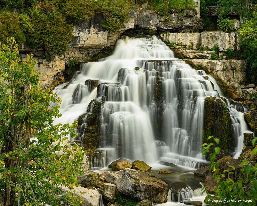
Inglis Falls. Photography by Andrew Forget
INGLIS FALLS, OWEN SOUND
Situated in the heart of the 200-hectare Inglis Falls Conservation Area, Inglis Falls is an 18-metre-high cascade, created by the Sydenham River meeting the edge of the Niagara Escarpment. One the most impressive of the Grey County waterfalls, the erosive power of the plunge has carved a deep gorge at the base of the falls. Inglis Falls can be enjoyed from the paved walkway or the viewing platform. The waterfall is conveniently located right off the parking lot.
DRIVING DIRECTIONS: Inglis Falls Conservation Area is located at 237785 Inglis Falls Rd, Owen Sound.
GPS LOCATION: 44.52642, -80.93426
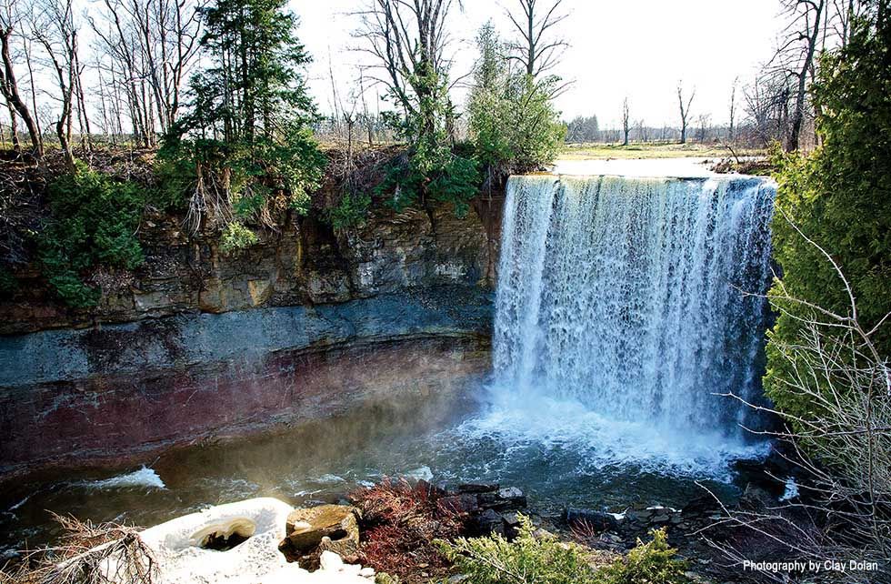
Indian Falls. Photography by Clay Dolan
INDIAN FALLS, GEORGIAN BLUFFS
Located in Sarawak Township at the northwestern edge of Owen Sound, this horseshoe shaped waterfall lies at the terminus of a 1km hike through the Indian Falls Conservation Area. From here you can see the falls drop into a pool before Indian Creek flows into Owen Sound Bay. Similar to Niagara Falls, the 15-metre-high waterfall was formed by the erosion of soft Queenston shale beneath hard Manitoulin dolomite. Despite being only 1km to the falls, the trail is tough, sometimes steep, and often runs right along the edge of the river. Please note, access to the base of the falls is strictly prohibited.
DRIVING DIRECTIONS: 318614 Grey Rd 1, Georgian Bluffs. Follow the scenic Georgian Bay Route from 2nd Avenue West to Grey Road 1.
GPS LOCATION: 44.62131, -80.95416
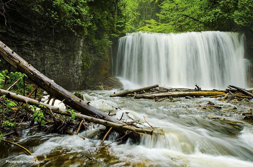
Hogg’s Falls. Photography by Clay Dolan
HOGG’S FALLS, FLESHERTON
Hogg’s Falls are tucked away a mere two-minute walk from the Lower Valley Road near Flesherton. Named for William Hogg, the waters of the Boyne River tumble 7-metres in this woodland setting. Avid hikers can travel from Hogg’s Falls to Eugenia Falls or choose to loop the side trails, creating a 13km round trip.
DRIVING DIRECTIONS: Take Highway 4 west to the East Back Line north. Turn east on Lower Valley Road. Watch carefully; the only entrance markings are two yellow posts on the north side of the road. Look for the sign displaying the parking lot area. 170491-172753, Lower Valley Rd.
GPS LOCATION: 44.28687, -80.54370
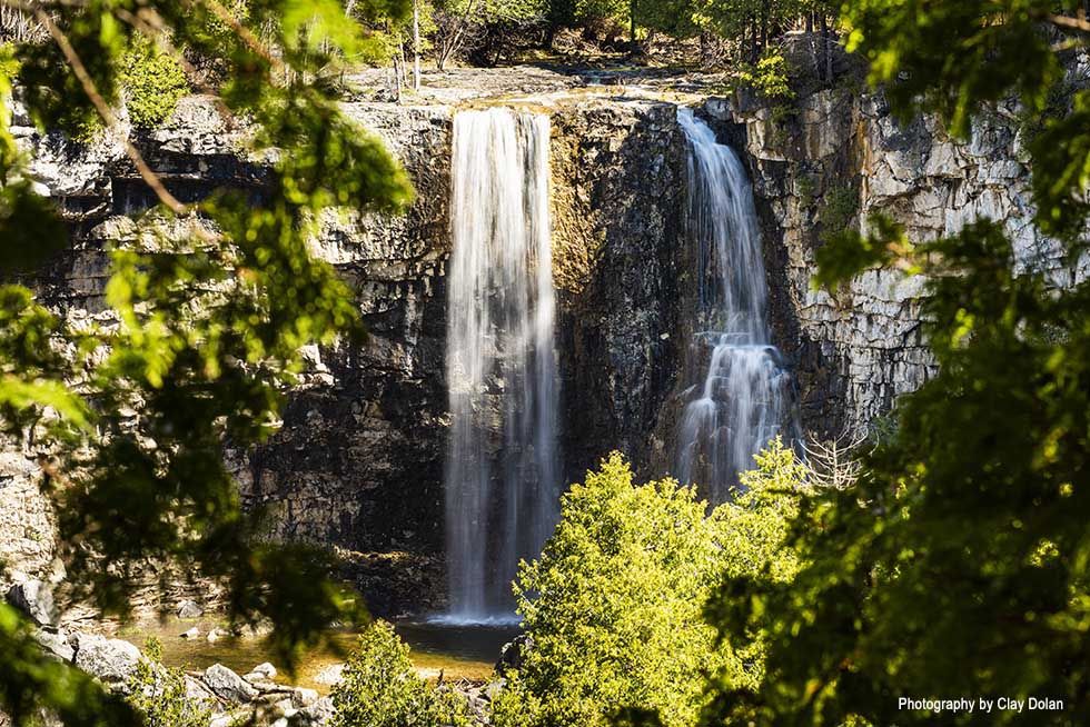
Eugenia Falls. Photography by Clay Dolan
EUGENIA FALLS, EUGENIA
The tallest waterfall in Grey County is situated in the quaint village of Eugenia. This impressive 30-metre waterfall thunders into the steep-sided Cuckoo Valley gorge. A short walk from the parking area, there is an overlook right on top of the falls. Follow the trail downstream for an even more impressive view. From the parking lot, follow the paved path to the falls where you will join up with the main tract of the Bruce Trail.
DRIVING DIRECTIONS: The entrance to Eugenia Falls Conservation Area is located at the end of Pellisier Street in the village of Eugenia.
GPS LOCATION: 44.31326, -80.52659
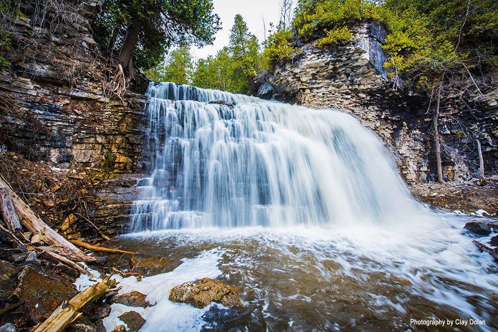
Jones Falls. Photography by Clay Dolan
JONES FALLS, OWEN SOUND
Viewed from the Bruce Trail, or glimpsed from Highway 21 heading west from Owen Sound, Jones Falls is located in the Pottawatomi Conservation Area. Here, the falls cascade an impressive 12-metres over the Escarpment. A 1km walking trail leads through the Pottawatomi Conservation Area to the falls. Follow the trail and the growing roar of the falls, but tread carefully. Enjoy the view atop the Escarpment or follow a short side trail to the base of the falls.
DRIVING DIRECTIONS: Pottawatomi Conservation Area parking and tourist information center are located at 717875 Highway 6 in Owen Sound.
GPS LOCATION: 44.559, – 80.9855
LESSER KNOWN FALLS
These under-the-radar falls might just be Grey & Bruce County’s best kept secret.
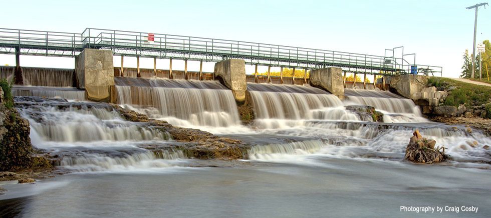
McGowan Falls. Photography by Craig Cosby
MCGOWAN FALLS, DURHAM
Nestled along a picturesque stretch of the winding Saugeen River, McGowan Falls is a small, flat cascade waterfall with a drop of 1.5 metres and a crest of 9-metres. Found within the Durham Conservation Area, McGowan Falls is easily accessible, and only a 2-minute walk from the parking lot. The trail surface consists of a combination gravel, grass and hard packed earth and rock and is wheelchair accessible.
DRIVING DIRECTIONS: The main entrance to the Durham Conservation Area is 323198 Durham Rd. E.
GPS LOCATION: 44.17915, -80.80870
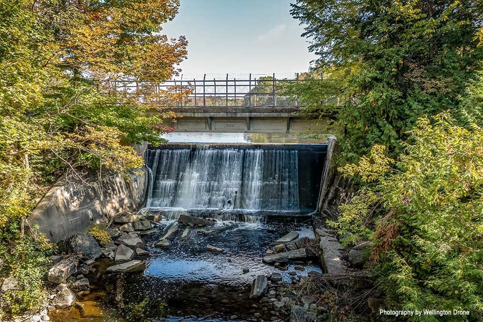
Holstein Dam. Photography by Wellington Drone
HOLSTEIN DAM, HOLSTEIN
This charming 5-metre dam waterfall is the most southerly of the Grey County waterfalls and is located in Holstein’s Jubilee Park. Norman Reeves Creek was dammed in 1881 during construction of the railroad—while the falls and dam are easily viewed from Jubilee Park the best vantage point is from from the old railway trail that runs along the top of the dam.
DRIVING DIRECTIONS: The Jubilee Park parking lot is at 392057 Grey County Road 109, Holstein.
GPS LOCATION: 44.061416, -80.754736
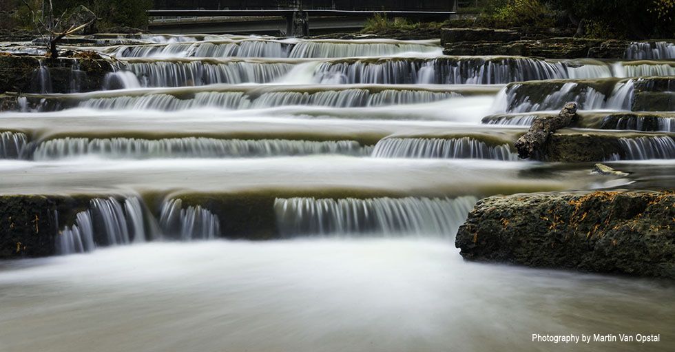
Sauble Falls. Photography by Martin Van Opstal
SAUBLE FALLS, WIARTON
Unlike nearly all of the waterfalls along the Escarpment, Sauble Falls is comprised of naturally formed low, long and wide limestone steps. Located within Sauble Falls Provincial Park in the southern Bruce Peninsula, the falls reach the lower drainage basin of the Sauble River, which flows into Lake Huron. This hot-spot is extremely popular as it is easily reachable from Hwy 21 and serves as a natural water slide in the summer months. Each spring and fall, rainbow trout and chinook salmon jump upstream over the cascading waterfall to spawn.
DRIVING DIRECTIONS: 1400 Sauble Falls Rd, Wiarton
GPS LOCATION: 44.67624, -81.25651
HIDDEN GEMS
Feeling adventurous? There are several stunning waterfalls in Grey Bruce that take a little more effort to reach. Put these hidden gems on your waterfall bucket list and chase those waterfalls.
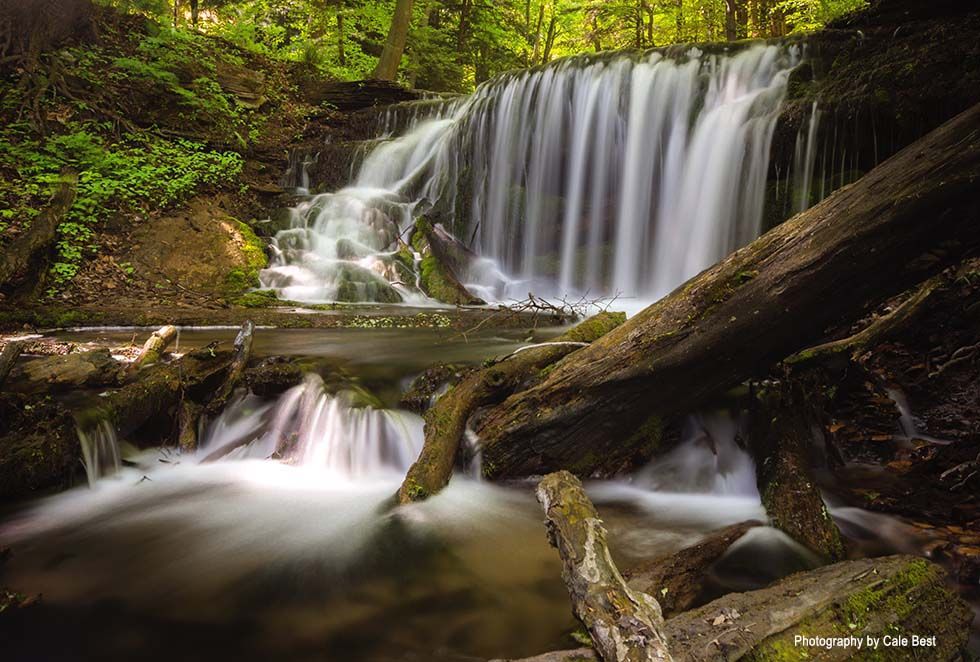
Weavers Creek Falls. Photography by Cale Best
WEAVERS CREEK FALLS, OWEN SOUND
Situated on the picturesque Sydenham River, Weavers Creek runs through the heart of Harrison Park in Owen Sound. The falls lie at the end of a short, easy to navigate 300-metre boardwalk that winds through the forest behind Harrison Park’s outdoor pool. These falls are a striking mix of plunge and cascade and are located on private property, so please enjoy the view from the walking path.
DRIVING DIRECTIONS: Harrison Park is located at 75 2nd Ave East.
GPS LOCATION: 44.542192, -80.937351
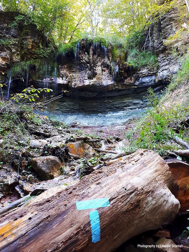
Hilts Falls. Photography by Leanne Scanlan
HILTS FALLS, GREY HIGHLANDS
The newest addition to any Grey County waterfall route, this relatively unknown waterfall is located on the Stew Hilts Side Trail, a 1.9km looped trail that connects with the main Bruce Trail near Markdale and Flesherton. Honouring Stew Hilts, a long-standing member of the Bruce Trail Conservancy, the trail was completed by the Beaver Valley Bruce Trail Club in 2019. The waterfall drops about 9-metres over dolostone and shale before flowing down the valley slope toward the Boyne River in the upper reaches of the Beaver Valley. This new expanse of trail also offers scenic views of Old Baldy to the northeast, and the Cuckoo Valley and Eugenia Falls to the east. The main trail runs from the Johnston’s Sideroad parking lot (km. 70.1) east and then south into the forest along the wester slope of the Valley. Be sure to wear sturdy footwear as the trail is fresh and very uneven.
DRIVING DIRECTIONS: Heading north along Grey County Road 32 from Highway 10, follow it until you come upon Johnston’s Sideroad. Park in the lot on the north side of Johnston’s Sideroad.
GPS LOCATION: 44.315674, -80.549984
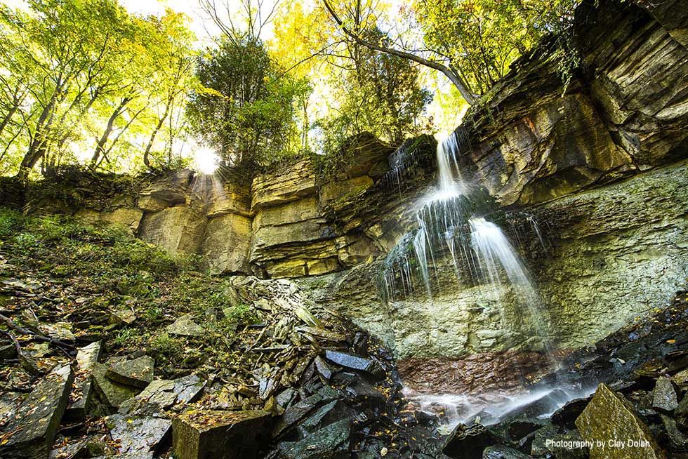
Webwood Falls. Photography by Clay Dolan
WEBWOOD FALLS, KIMBERLEY
Located on the Beaver Valley Section of the Bruce Trail, 14km southwest of Thornbury, Webwood Falls is one of the smaller Grey County waterfalls but its location adds to the lure. Formerly known as Fairmount Falls, Webwood Falls Nature Reserve was established thanks to the generous donation of Mr. James Horwood. Named in memory of his parents, Webwood Falls and the area surrounding it are protected by the Bruce Trail Conservancy. The waterfall is accessed via a short 100-metre walk from a small parking area. Here, two lesser streams meet to form the impressive stream that tumbles 15-metres over the crest. Webwood Falls is found within a very delicate eco-system and visitors are asked to stay on the clearly marked Bruce Trail and observation deck.
DRIVING DIRECTIONS: Located on Sideroad 25 Grey Highlands, north of Kimberly. Parking is very limited and it is not safe to park on the road.
GPS LOCATION: 44.494833, -80.546406
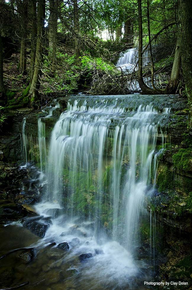
Duncan Crevice Caves. Photography by Clay Dolan
DUNCAN CREVICE CAVES, DUNCAN
Set within the lush Duncan Escarpment Provincial Park, this pair of waterfalls cascade 3-to-5-metres and are a stunning distraction for hikers. The trail at the Duncan Escarpment Provincial Nature Area, also known as the Duncan Crevice Caves, is a 10.5km moderate loop trail, lined with impressive chunks of limestone that have split due to extreme temperatures, creating a labyrinth of tunnels, falls, grottos and slender passageways. The Duncan Escarpment is part of the Niagara Escarpment Parks System and the Niagara Biosphere Reserve and visitors should be mindful that the ecosystem is vulnerable and easily damaged.
DRIVING DIRECTIONS: Bruce Trail Lot near Duncan on 9th Sideroad.
GPS LOCATION: 44.4223,-80.4764
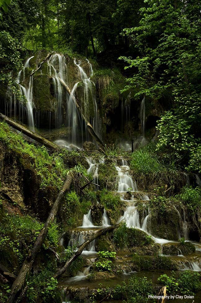
Beaver Valley Falling Water Trail. Photography by Clay Dolan
BEAVER VALLEY FALLING WATER TRAIL, EUGENIA
Looking for out-of-the-way, unmarked waterfalls? The Falling Water Trail is a 30.5km loop within the Bruce Trail, that connects two magnificent waterfalls: Hogg’s Falls and Eugenia Falls. Including loops and side trails, the Falling Water Trail offers dozens of stunning vantage points and at almost any point on the trail, the sound of rushing water can be heard—from the babbling of gentle brooks to at least five more waterfalls ranging from a roar to a tinkle. The Beaver Valley Bruce Trail Club hosts a unique trail running race, named the Falling Water Trail Marathon. Distances are: 42.2k and 21.1k. This year’s event takes place on August 13-14, 2022.
DRIVING DIRECTIONS: From Flesherton, take Highway 4 East, turn left on East Back Line, right on Lower Valley Road, and park at Hogg’s Falls. There’s also a parking lot at Eugenia Falls Conservation Area and roadside parking at other access points.
GPS LOCATION: 44.28687, -80.54370

